-
 Univers
-
 Ebooks
-
 Livres audio
-
 Presse
-
 Podcasts
-
 BD
BD
-
 Documents
-
- Cours
- Révisions
- Ressources pédagogiques
- Sciences de l’éducation
- Manuels scolaires
- Langues
- Travaux de classe
- Annales de BEP
- Etudes supérieures
- Maternelle et primaire
- Fiches de lecture
- Orientation scolaire
- Méthodologie
- Corrigés de devoir
- Annales d’examens et concours
- Annales du bac
- Annales du brevet
- Rapports de stage
La lecture à portée de main

241 pages
English
Découvre YouScribe en t'inscrivant gratuitement
Je m'inscrisDécouvre YouScribe en t'inscrivant gratuitement
Je m'inscris
Obtenez un accès à la bibliothèque pour le consulter en ligne
En savoir plus
En savoir plus
241 pages
English
Obtenez un accès à la bibliothèque pour le consulter en ligne
En savoir plus
En savoir plus

Description
An archaeological investigation into the ancient nucleus of medieval and modern Cairo
This book presents a history of Old Cairo based on new archaeological evidence gathered between 2000 and 2006 during a major project to lower the groundwater level affecting the churches and monuments of this area of Cairo known by the Romans as Babylon. Examination of the material and structural remains revealed a sequence of continuous occupation extending from the sixth century BC to the present day. These include the massive stone walls of the canal linking the Nile to the Red Sea, and the harbor constructed by Trajan at its entrance around AD 110.
The Emperor Diocletian built the fortress of Babylon around the harbor and the canal in AD 300, and much new information has come to light concerning the construction and internal layout of the fortress, which continues to enclose and define the enclave of Old Cairo. Important evidence for the early medieval transformation of the area into the nucleus of the Arab city of al-Fustat and its later medieval development is also presented.
Sujets
Informations
| Publié par | The American University in Cairo Press |
| Date de parution | 01 octobre 2010 |
| Nombre de lectures | 2 |
| EAN13 | 9781617976100 |
| Langue | English |
| Poids de l'ouvrage | 151 Mo |
Informations légales : prix de location à la page 0,2450€. Cette information est donnée uniquement à titre indicatif conformément à la législation en vigueur.
Extrait
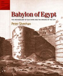
Babylon of Egypt
American Research Center in Egypt Conservation Series 4
Babylon of Egypt The Archaeology of Old Cairo and the Origins of the City
Peter Sheehan
An American Research Center in Egypt Edition The American University in Cairo Press Cairo New York
Sources of Illustrations: Travelers in the Middle East Archive: fig. 5; The British Library: figs. 6, 17; Michael Mallinson: fig. 8, pls. 38, 39; Jose Santos: figs. 9, 51, pl. 34; Rare Books and Special Collections Library, American University in Cairo: figs. 13, 35, 39, 49, 50, 58, 59, 61, pl. 35; Lehnert and Landrock: fig. 14; Fotocea Unione, American Academy in Rome: fig. 22; Comité and SCA archives: figs. 28, 29, 46, 54, 62, 64, 65, 66, 67, 68, 69, 71, 72, 73, 74, 75; Mohammed Fahmy: figs. 38, 47; Nicholas Warner: fig. 45; Canadian Centre for Architecture: fig. 55; Institut français d’archéologie orientale (IFAO); fig. 60, pl. 27; Peter Sheehan: figs. 70, 76; K Lutley and J Bunbury: pl. 18; Imaging Papyri Project, University of Oxford and Egypt Exploration Society: pl. 25.
First published in 2010 by The American University in Cairo Press 113 Sharia Kasr el Aini, Cairo, Egypt 420 Fifth Avenue, New York, NY 10018 www.aucpress.com
Copyright © 2010 The American Research Center in Egypt 2 Midan Simón Bolívar, Garden City, Cairo, Egypt 8700 Crownhill Blvd., Suite 507, San Antonio, TX 78209
This publication is made possible by the generous support of the American people through the United States Agency for International Development (USAID). The contents are the responsibility of the author and do not necessarily reflect the views of USAID or the United States Government.
All rights reserved. No part of this publication may be reproduced, stored in a retrieval system, or transmitted in any form or by any means, electronic, mechanical, photocopying, recording, or otherwise, without the prior written permission of the publisher.
Dar el Kutub No. 4133/09 ISBN 978 977 416 299 2
Dar el Kutub Cataloging-in-Publication Data
Sheehan, Peter Babylon of Egypt: The Archaeology of Old Cairo and the Origins of the City / Peter Sheehan.—Cairo: The American University in Cairo Press, 2010 p. cm. ISBN 978 977 416 299 2 1. Ancient Egypt—Antiquities I. Title
1 2 3 4 5 6 15 14 13 12 11 10
Designed by Sally Boylan Printed in Egypt
List of Illustrations ForewordGerry D. Scott, III and Michael Jones Acknowledgments Timeline of Significant Events
Introduction Old Cairo: Topography and Archaeology Toward an Archaeological Model of Old Cairo
Part 1 The Making of Babylon
1 The Ancient Landscape of Cairo Introduction Geological Background The Nile at Cairo The Earliest Settlements on the East Bank at Cairo The Archaeology of the Ancient Landscape at Old Cairo
Contents
2 The River of Trajan Introduction Connecting the Nile with the Red Sea Trajan’s Canal and the Harbor of Old Cairo Archaeological Evidence from Old Cairo for the Canal and the Harbor of Trajan Archaeological Evidence for the Wider Roman Landscape of Cairo The Heritage of the Canal and Its Importance to the Later Topography and Development of the City of Cairo
vii xi xiii xvii
1 8 18
21
23 23 24 25 29 32
35 35 35 40
42 51
51
3 Diocletian and the Roman Fortress of Babylon The Building Campaign of Diocletian in Context The Building Campaign of Diocletian: The Topography of the Roman Fortress of Babylon The Archaeology of Diocletian’s Fortress Postscript: Babylon between Diocletian and the Arab Conquest
Part 2 The Making of Old Cairo
4 AlFustat and the Making of Old Cairo From Fortress to City: Babylon as the Nucleus of alFustat and Its Role in the Development of Medieval Cairo Archaeological Evidence for the Making of Old Cairo AlFustat and the Early Medieval Making of Old Cairo Topographical Influences on the Foundation of alFustat: The River and the Canal, Ancient and New Roads The Reuse of the Roman Fortress The Archaeological Evidence for the Foundation of the First Churches in Cairo The Rebuilding of Old Cairo from the End of the Tenth Century
5 Cycles of Decline and Revival: Ayyubid, Mamluk, and Ottoman Old Cairo Introduction The Changing Medieval Topography of Cairo and the Position of Old Cairo within the Metropolis The Churches and the Medieval Archaeology of Old Cairo Early Ottoman Decline and the EighteenthCentury Revival under the “Sultan of the Copts”
6 The ReMaking of Old Cairo in the Image of Its Past The Rediscovery of Old Cairo at the End of the Nineteenth Century The Work of the Comité in Old Cairo The Activities of the Jewish Community around the Ben Ezra Synagogue from 1892 to 1948 Old Cairo: The Present and the Future
Notes References Glossary Index
55 55
59 67 74
77
79
79 82 85
85 86
88 92
97 97
99 105
115
121 121 128
136 137
143 157 167 171
Figures
1. 2.
3. 4. 5.
6.
7.
8.
9. 10.
11.
12. 13. 14.
15.
16.
17.
18.
19.
Egypt and the Near East c.AD110. Babylon in context: Topographic and urban features of the East Bank of the Nile at Cairo. Plan showing the monuments of Old Cairo. Axonometric view of the monuments of Old Cairo. Greek Church of St. George viewed from the railway in a postcard of c. 1930. Midnineteenthcentury view of the Greek Church of St. George and the entrance to Old Cairo. Modern view of the entrance to Old Cairo from Shari‘ Mari Girgis. Approach to the arched entrance of Haret Abu Serga from the north, taken in 1984. Early nineteenthcentury plan of Old Cairo. Plan of Contract 102 shaft locations in the core area of the project. Concrete blocks loaded onto one of the shafts to make it sink. A bronze processional cross from Abu Serga. Alfred Butler’s 1884 plan of Old Cairo. Nineteenthcentury view of the Pyramids taken dur ing the Nile inundation. Part of a stele of Tuthmosis III found 10 m below modern ground level in Shaft HC 1. Amphora handle stamped with the flaming torch motif of the potter Sokrates II. Bourdon’s 1925 plan of the ancient and modern canals linking the Nile with the Red Sea. Posener’s sketchplan showing the find locations of the Persian stelae. Plan showing the areas of the Trajanic canal and harbor.
vii
20.
21. 22.
23.
24.
25.
26. 27.
28. 29.
30.
31. 32. 33. 34.
35. 36.
37. 38.
39. 40.
Illustrations
The stepped Trajanic quayside below the eastern tower of the South Gate at Babylon. Slots for the swallowtailed bronze cramps. Relief showing the unloading of amphorae from boat to quayside. The stone block from the Trajanic harbor wall recov ered from Shaft HC3. Axonometric of the southwest corner of the Trajanic harbor and the later fortress. Plan of Old Cairo showing the areas of the Roman fortress standing above ground. Reconstructed plan of the Roman fortress. Axonometric reconstruction of the Roman fortress and the entrance to the Amnis Traianus c.AD300. The surviving southern side of the East Gate. Excavations in the southern round tower in the late 1940s. Decorated blocks reused in the foundations of the western flanking tower of the South Gate. Plan of the round towers. Section through the round towers. Axonometric view of the round towers. The original stonework of the entrance to the south ern round tower. Pococke’s 1734 plan of the Roman fortress. Axonometric reconstruction of the Roman barracks in the area of the Ben Ezra Synagogue. An early Islamic aqueduct at Istabl ‘Antar. Plan showing alFustat, al‘Askar, and alQatai taken from Bahgat Bey’s 1921Fouilles d’alFoustat. Pococke’s 1734 ‘Chorograph of Grand Cairo.’ Plan of Abu Serga Church showing the phases of its development.
41.
42.
43.
44.
45. 46. 47. 48. 49.
50. 51. 52.
53.
54. 55. 56.
57.
58.
59. 60. 61. 62.
63. 64. 65. 66. 67. 68. 69.
70.
71.
72.
73.
74.
viii
Axonometric view of Abu Serga Church showing the new archaeological information. Abu Serga protochurch: Part of the colonnade of the early church. Remains of the vaulted tombs in the nave of Abu Serga church. The early medieval building revealed beneath the floor of the Convent of St. George. Cairo around 1800. From theDescription de l'Egypte. Comité plan of the Convent of St. George. Plan from Bahgat Bey’s 1921Fouilles d’alFoustat. The 1918 Survey of Egypt plan. Frederik Norden’s plan of the island of Roda from 1757. Niebuhr plan of Cairo, 1774. Engraving of the Battle of the Pyramids, 1798. The Church of Abu Serga. Remains of the tall medieval niche in the central sanctuary. Axonometric view of the qa‘a or medieval hall of the Convent of St George. Comité plan of the Wedding Hall. The Ben Ezra Synagogue: The medieval mastaba. Abu Serga: Marble cross from the medieval floor of the crypt. Abu Serga: Terra Santa cross on the main façade of the church. Abu Serga crypt: A detail of one of the patches of limestone medieval floor. Alfred Butler’s plan of Abu Serga. Jullien’s view of Old Cairo. Caetani’s 1911 panoramic photograph of Old Cairo. Panoramic photograph of Old Cairo after the disas trous fire of 1904. The Ottoman façade of ‘Atfat Abu Serga. Somers Clarke view of the South Gate of Babylon. Somers Clarke view of the Hanging Church. Comité detail of the interior of the Hanging Church. Comité section through the northern round tower. A 1897 view of the southern round tower. Unpublished proof of a cross section through the South Gate and the Hanging Church. A view of the southern round tower probably taken in the 1930s. An early photograph taken by the Comité of Abu Serga around 1897. A photograph taken in the crypt of Abu Serga around 1919. The façade of the Church of St. Barbara before the Comité restoration. The façade of the Church of St. Barbara after the Comité restoration.
Illustrations
75.
76.
77.
78.
A photograph taken around 1950 showing the façade of the Convent of St. George. Architectural drawings from 1909 showing a pro posed design for the Greek Church of St. George. Vaulted tombs of the former Catholic cemetery in the Muqauqas area. The arch leading to the hara of Abu Serga as rebuilt in 2008.
Plates 1. Aerial view of Old Cairo looking north. 2. Aerial view of Old Cairo looking southeast. 3. Aerial view of the Mosque of ‘Amr looking east. 4. Aerial view of the Mosque of ‘Amr, Old Cairo, and the Nile looking southwest. 5. Façade of the Ottomanperiodsabilat the east end of the Harat Dayr Mari Girgis. 6. A general view of the church of Qasriyat alRihan taken in 2000. 7. Ceramics workroom at the SCA inspectorate in al Fustat. 8. The groundwater level under Mari Girgis Church before the project began. 9. Groundwater level in the crypt of Abu Serga Church before works began. 10. Part of the complex medieval drainage system below the Convent of St. George. 11. Mari Girgis: The northern round tower and the 1940s arcade, looking east. 12. Mari Girgis: The northern round tower and the 1940s arcade, looking west. 13. Material excavated during a night shift at Shaft 7. 14. A Roman stone wall 2.5 meters below the modern ground surface in Shaft 5. 15. The massive stone wall forming the eastern side of the Amnis Traianus. 16. Medieval wall paintings in the southern apsidal sanc tuary of Abu Serga Church. 17. Detail of the Abu Serga wall paintings during the conservation work. 18. Shifts in the course of the main channel of the ancient Nile in the Cairo area from 5000 to 500BP. 19. The lionheaded mooring post from the Trajanic harbor wall coming to the surface. 20. The north end of the earlier Trajanic quay wall revealed in the westernmost room of the southern round tower. 21. The curving outer face of the quayside wall beneath Mari Girgis Church. 22. The huge stone column base within the niche of the northern tower.
23.
24.
25.
26. 27.
28.
29. 30. 31.
32.
33.
34.
35.
The massive stone wall built between the round tow ers to block the entrance to the canal. The central arcade of the southern round tower of the Roman fortress. Fragment of an Oxyrhyncus papyrus of 208 mention ing the Canal of Trajan. The South Gate of the Roman Fortress of Babylon. A comparison of the plans of the Roman fortresses at Babylon and Luxor Temple. Detail of one of the columns in the central arcade of the northern round tower. The entrance to the northern round tower. First floor arcade in the northern round tower. The north wall of Abu Serga showing how the ground level rises to the east. The entrance to the crypt of Abu Serga from the north sanctuary. The entrance to the crypt of Abu Serga from the south sanctuary. Pagano map variant 1549 showing the urban layout of Cairo. Claude Sicard’s view of Old Cairo from 1715.
36.
37.
38.
39.
40.
41.
42.
43.
44.
45.
46.
The Convent of St. George: Medieval foundations below the great wooden doors. Eighteenthcentury painted wooden ciborium from Abu Serga. A 1984 view of the Ottoman house façade in ‘Atfat Mari Girgis. A 1984 view of the Ottoman house to the north of Abu Serga church, demolished in 1989. Mari Girgis. The central area of the northern round tower. Medieval vaulted cistern to the east of the northern round tower. Abu Serga: The columns of the crypt separating the ‘nave’ and the northern aisle. Two blocked doorways to the southern sanctuary of Abu Serga. A view of the exterior of the central apse of Abu Serga. Painted figures of saints on the columns of the nave in Abu Serga. The ornate interior of the Greek Orthodox Church of St. George.
Illustrations ix
-
Univers
-
Ebooks
-
Livres audio
-
Presse
-
Podcasts
-
BD
-
Documents
-
Jeunesse
-
Littérature
-
Ressources professionnelles
-
Santé et bien-être
-
Savoirs
-
Education
-
Loisirs et hobbies
-
Art, musique et cinéma
-
Actualité et débat de société
-
Jeunesse
-
Littérature
-
Ressources professionnelles
-
Santé et bien-être
-
Savoirs
-
Education
-
Loisirs et hobbies
-
Art, musique et cinéma
-
Actualité et débat de société
-
Actualités
-
Lifestyle
-
Presse jeunesse
-
Presse professionnelle
-
Pratique
-
Presse sportive
-
Presse internationale
-
Culture & Médias
-
Action et Aventures
-
Science-fiction et Fantasy
-
Société
-
Jeunesse
-
Littérature
-
Ressources professionnelles
-
Santé et bien-être
-
Savoirs
-
Education
-
Loisirs et hobbies
-
Art, musique et cinéma
-
Actualité et débat de société
- Cours
- Révisions
- Ressources pédagogiques
- Sciences de l’éducation
- Manuels scolaires
- Langues
- Travaux de classe
- Annales de BEP
- Etudes supérieures
- Maternelle et primaire
- Fiches de lecture
- Orientation scolaire
- Méthodologie
- Corrigés de devoir
- Annales d’examens et concours
- Annales du bac
- Annales du brevet
- Rapports de stage
Signaler un problème


YouScribe
Le catalogue
Le service
© 2010-2024 YouScribe