-
 Univers
-
 Ebooks
-
 Livres audio
-
 Presse
-
 Podcasts
-
 BD
BD
-
 Documents
-
- Cours
- Révisions
- Ressources pédagogiques
- Sciences de l’éducation
- Manuels scolaires
- Langues
- Travaux de classe
- Annales de BEP
- Etudes supérieures
- Maternelle et primaire
- Fiches de lecture
- Orientation scolaire
- Méthodologie
- Corrigés de devoir
- Annales d’examens et concours
- Annales du bac
- Annales du brevet
- Rapports de stage
La lecture à portée de main

Découvre YouScribe en t'inscrivant gratuitement
Je m'inscrisDécouvre YouScribe en t'inscrivant gratuitement
Je m'inscrisEn savoir plus
En savoir plus

Description
In the geophysics of oil exploration and reservoir studies, the surface seismic method is the most commonly used method to obtain a subsurface model in 2 or 3 dimensions. This method plays an increasingly important role in soil investigations for geotechnical, hydrogeological and site characterization studies regarding seismic hazard issues.
The goal of this book is to provide a practical guide, using examples from the field, to the application of seismic methods to surface imaging.
After reviewing the current state of knowledge in seismic wave propagation, refraction and reflection seismic methods, the book aims to describe how seismic tomography and fullwave form inversion methods can be used to obtain seismic images of the subsurface. Through various synthetic and field examples, the book highlights the benefit of combining different sets of data: refracted waves with reflected waves, and body waves with surface waves. With field data targeting shallow structures, it shows how more accurate geophysical models can be obtained by using the proposed hybrid methods. Finally, it shows how the integration of seismic data (3D survey and VSP), logging data (acoustic logging) and core measurements, combined with a succession of specific and advanced processing techniques, enables the development of a 3D high resolution geological model in depth.
In addition to these examples, the authors provide readers with guidelines to carry out these operations, in terms of acquisition, as well as processing and interpretation.
In each chapter, the reader will find theoretical concepts, practical rules and, above all, actual application examples. For this reason, the book can be used as a text to accompany course lectures or continuing education seminars.
This book aims to promote the exchange of information among geologists, geophysicists, and engineers in geotechnical fields.
Sujets
Informations
| Publié par | EDP Sciences |
| Date de parution | 06 février 2019 |
| Nombre de lectures | 0 |
| EAN13 | 9782759823512 |
| Langue | English |
| Poids de l'ouvrage | 11 Mo |
Informations légales : prix de location à la page 0,0005€. Cette information est donnée uniquement à titre indicatif conformément à la législation en vigueur.
Extrait
PROfle - Jean-Luc Mari and Manuela Mendes
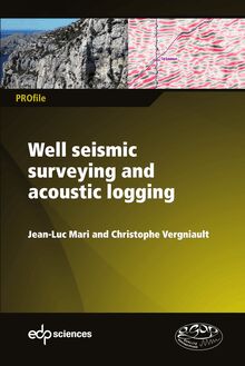
Seismic imaging: a practical approach
PROfle
Seismic imaging:
a practical approach
Jean-Luc Mari and Manuela Mendes
PROfle
In the geophysics of oil exploration and reservoir studies, the surface seismic method is the
most commonly used method to obtain a subsurface model in 2 or 3 dimensions. This method
plays an increasingly important role in soil investigations for geotechnical, hydrogeological
and site characterization studies regarding seismic hazard issues.
The goal of this book is to provide a practical guide, using examples from the field, to the
application of seismic methods to surface imaging. Seismic imaging: After reviewing the current state of knowledge in seismic wave propagation, refraction and
reflection seismic methods, the book aims to describe how seismic tomography and fullwave
form inversion methods can be used to obtain seismic images of the subsurface. Through
various synthetic and field examples, the book highlights the benefit of combining different a practical approach
sets of data: refracted waves with reflected waves, and body waves with surface waves. With
field data targeting shallow structures, it shows how more accurate geophysical models can
be obtained by using the proposed hybrid methods. Finally, it shows how the integration of
seismic data (3D survey and VSP), logging data (acoustic logging) and core measurements,
combined with a succession of specific and advanced processing techniques, enables the
development of a 3D high resolution geological model in depth.
In addition to these examples, the authors provide readers with guidelines to carry out these
operations, in terms of acquisition, as well as processing and interpretation.
Jean-Luc Mari and Manuela Mendes
In each chapter, the reader will find theoretical concepts, practical rules and, above all,
actual application examples. For this reason, the book can be used as a text to accompany
course lectures or continuing education seminars.
This book aims to promote the exchange of information among geologists, geophysicists,
and engineers in geotechnical fields.
978-2-7598-2351-2
Books of the PROfle collection are intended
for the transmission of professional knowledge
in different disciplines. They are written by
recognized experts in their felds and contribute
9782759 823512 www.edpsciences.org to the training and information of professionals.Seismic Imaging
A practical approachGÉ
OP
Q
HYSIQ
U
ALI
UE
APP
TÉ
LIQ
UÉE
Seismic Imaging
A practical approach
Jean-Luc Mari
Manuela MendesDOI: 10.1051/978-2-7598-2351-2
ISBN(ebook) : 978-2-7598-2351-2
This book is published in under Open Access Creative Commons License CC-BY-NC-ND
(https://creativecommons.org/licenses/by-nc-nd/4.0/en/) allowing non-commercial use,
distribution, reproduction of the text, via any medium, provided the source is cited.
© EDP Sciences, 2019Contents
Foreword 9
J.-L.Mari, M.Mendes
Introduction13
J.-L.Mari, M.Mendes
Chapter 1 • W av e pr opagation 17
J.-L. Mari
1.1 Seismic wave equation19
1.2 Seismic methods23
1.3 Example of field records26
1.4 Wave separation 30
1.5 Conclusion34
References34
Chapter2• Refraction surveying35
J.-L. Mari
2.1 Refraction surveying: Plus-Minus and GRM methods 36
2.2 Amplitudes of refracted waves42
2.3 Recommendations for refraction surveying 44
2.4 First example of a seismic refraction application: static corrections 46
5Seismic Imaging
2.5 Second example of a seismic refraction application: Hydrogeology 53
2.6 Conclusion 58
References59Chapter3• Seismic tomography63
M.Mendes
3.1Transmission tomography example: surface seismic field data 65
3.1.1 Geophysical survey 66
3.1.2 Tomographic methodology67
3.1.3 Data pre-processing68
3.1.4 Results and discussion69
3.1.5 Conclusions71
3.2 Reflection tomography example: cross-hole field data 73
3.2.1 Seismic survey74
3.2.2 Data processing 75
3.2.3 General interpretation76
3.2.4Conclusions77
3.3 Diffraction tomography example: Borehole field data 77
3.3.1Vertical seismic profile (VSP) field data78
3.3.2Cross-hole field data82
3.4 General conclusion89
References 89Chapter4•Near-surface reflection surveying 91
J.-L.Mari
4.1General notes about acquisition and survey design93
4.2Comments on the reflection seismic processing sequence 98
4.3 Near-surface imaging98
4.4 A Hydrogeology example 112
4.5 Conclusion120
References120
Chapter 5 • Full waveform inversion123
H. Chauris
5.1 Overview 123
5.2History124
5.3Formalism125
5.4Applicability and practical aspects 128
6Contents
5.5 Examples 133
5.6Conclusions142
References143Chapter6•Hybrid seismic imaging 147
M.Mendes, J.-L.Mari, M.Hayet
6.1Refraction-reflection imaging149
6.2 Refraction-surface waves imaging154
6.3 Conclusion161
References 162Chapter7•Integrated seismic study
Focus on “Cigéo”, the French geological
repository project163
J.-L.Mari and B.Yven
7.1Geological setting164
7.2Seismic designs and processing sequence 167
7.3 Depth conversion175
7.4 Amplitude quality control182
7.5 Q factor 183
7.6Mechanical properties188
7.7Hydrogeological Study193
7.8Conclusion195
Acknowledgements197
References197
Synthesis201
J.-L. Mari, M. Mendes, H. Chauris
Conclusion 205
J.-L.Mari, M.Mendes
7GÉ
OP
Q
HYSIQ
U
ALI
UE
APP
ÉT
ILQ
UÉE
1Foreword
J.-L. Mari, M. Mendes
Based on their experience in geophysics as applied to the oil and gas industry, and in
the geotechnical field, the authors have set out to explain how conventional seismic
methods used in deep exploration geophysics for imaging can be applied to certain
geotechnical and hydrogeological surveys, and to site characterizations in the
framework of seismic hazard studies. After reviewing the current state of knowledge in
seismic wave propagation, refraction and reflection seismic methods, the book aims
to describe how seismic tomography and full waveform inversion methods can be
used to obtain seismic images of the subsurface. The book highlights the benefit of
combining different seismic methods through various synthetic and field examples.
In addition to these examples, the authors provide readers with guidelines to carry
out these operations, in terms of acquisition, as well as processing and interpretation.
The authors thank Hervé Chauris, Béatrice Yven and Michel Hayet for their
contributions to this book.
Many thanks to Jim Johnson and Katell Guernic from Tamarin
(www.tamarintext.com) for the English revision of the book.
This chapter of Seismic Imaging: a practical approach is published under Open Source Creative
Commons License CC-BY-NC-ND allowing non-commercial use, distribution, reproduction of
the text, via any medium, provided the source is cited.
© EDP Sciences, 2019
DOI: 10.1051/978-2-7598-2351-2.c001
9Seismic Imaging
The authors
Jean-Luc Mari
A graduate of the Institut Physique du Globe Strasbourg and
the IFP School (petroleum geosciences, major in
geophysics in 1978), Jean-Luc Mari was employed by IFP Energies
Nouvelles in 1979 as a research engineer in the Geophysics
Department. Here he worked on several research projects,
such as high-resolution seismic surveying, reservoir
monitoring, and the development of borehole tools, in
collaboration with industrial partners GdF-Suez, CGG, Total
and ELF Aquitaine.
In 1986, he was seconded to ELF Aquitaine where he
worked on reservoir geophysics. He joined IFPEN in 1987
and was seconded to the Reservoir Department, where he studied, in particular, the
benefits of using geophysical methods in horizontal wells. In 1994 he was appointed
to the IFP School as a professor and obtained the accreditation to supervise earth
science research (HDR). He was an expert in geophysics for IFP Energies Nouvelles.
Jean-Luc was a member of the EAGE and an associate editor for Near Surface
Geophysics. Currently retired from IFP Energies Nouvelles, Jean-Luc is an
independent researcher and consultant in geophysics. He is a member of the board and of
the accreditation committee for the Association for Quality in Applied Geophysics
(AGAP - Association pour la Qualité en Géophysique Appliquée).
An author and co-author of patents and numerous scientific articles, Jean-Luc Mari
has also contributed to educational scientific books and has been involved in the
design and development of online learning modules, tutorials and e-books. In 2010,
he received a Knighthood from the Ordre des Palmes Académiques.
Email: jeanluc90.mari@gmail.com
Manuela Mendes
Since 1990, Manuela Mendes has been an assistant
professor at the Instituto Superior Técnico, Portugal.
She received an MSc. (1986) in Geophysics and a PhD.
(1989) in Earth Sciences from the University of Paris VII.
During 1977-1978 she worked as a geophysicist at the
Institute of Geosciences, Azores Island.
In 1989 Manuela worked as a researcher at the Compagnie
Générale de Géophysique (CGG), France, and participated
10Foreword
in several seismic imaging research projects during 1998-1999 and 2003-2004 at
the Institut Français du Pétrole (IFP), France.
She contributes regularly to peer reviewing, academic committees and is an
expertevaluator for the European Commission. Her main research interests are
seismicvolcanic risk and seismic imaging applications for the oil industry, the environment
and culture heritage.
Manuela Mendes is a member of EAGE.
Email: d1865mm@gmail.com
Hervé Chauris
Hervé Chauris graduated in 1996 from the École des Mines
de Paris (Paris School of Mines, France), as a civil
engineer. After a research master in Geophysics, he attained
a PhD in Geophysics from the École des Mines de Paris.
He then worked for Shell in Rijswijk, The Netherlands,
between 2000 and 2005, within the seismic imaging
R&D department. He became an associate professor at
MINES ParisTech in 2006, before taking on a full
professor position at the same institute in 2011.
Hervé completed his accreditation to supervise research
in earth sciences (HDR) in 2010, on the theme “seismic
imaging from locally
-
Univers
-
Ebooks
-
Livres audio
-
Presse
-
Podcasts
-
BD
-
Documents
-
Jeunesse
-
Littérature
-
Ressources professionnelles
-
Santé et bien-être
-
Savoirs
-
Education
-
Loisirs et hobbies
-
Art, musique et cinéma
-
Actualité et débat de société
-
Jeunesse
-
Littérature
-
Ressources professionnelles
-
Santé et bien-être
-
Savoirs
-
Education
-
Loisirs et hobbies
-
Art, musique et cinéma
-
Actualité et débat de société
-
Actualités
-
Lifestyle
-
Presse jeunesse
-
Presse professionnelle
-
Pratique
-
Presse sportive
-
Presse internationale
-
Culture & Médias
-
Action et Aventures
-
Science-fiction et Fantasy
-
Société
-
Jeunesse
-
Littérature
-
Ressources professionnelles
-
Santé et bien-être
-
Savoirs
-
Education
-
Loisirs et hobbies
-
Art, musique et cinéma
-
Actualité et débat de société
- Cours
- Révisions
- Ressources pédagogiques
- Sciences de l’éducation
- Manuels scolaires
- Langues
- Travaux de classe
- Annales de BEP
- Etudes supérieures
- Maternelle et primaire
- Fiches de lecture
- Orientation scolaire
- Méthodologie
- Corrigés de devoir
- Annales d’examens et concours
- Annales du bac
- Annales du brevet
- Rapports de stage

